
Introduction to Climate
 The climate of a place may be defined as a "composite" of the long-term prevailing weather that occurs at that location. In a sense, climate is "average weather". Climate can be measured quantitatively by calculating the long term averages of different climate elements such as temperature and rainfall. Extremes in the weather however, also help us define the climate of a particular area.
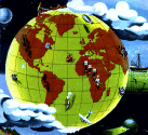
We can study climate on a range of geographical scales. At the smallest scale, local climates influence areas maybe only a few miles or tens of miles across. Examples of local climatic phenomena include sea breezes and urban heating. At larger scales, regional climates provide a picture of particular patterns of weather within individual countries, or within climate zones that exist at different latitudes on the Earth. Climate zones include tropical, subtropical, desert, Savannah, temperate and polar climates. Different climate zones reveal variable patterns of temperature and rainfall. At the largest scale of all, climatologists study the global climate, for example when they are interested in how it has changed in the past, and how it may change in the future.
There are many influences on the climate of a particular place, the most important of which is latitude. Places nearer the equator receive more sunlight and are much warmer than places nearer poles. This temperature difference between low and high latitudes drives the general circulation of the atmosphere, transferring heat away from the equator towards the poles. The general circulation is split into a number of circulation cells which define separate pressure zones and belts of wind. These wind belts are sometimes called the prevailing winds. They blow more east-west than north-south however, because they are deflected by the Coriolis force, due to the Earth's rotation. The wind belts shift with the seasons, and so too, therefore, do the climate zones.
Other influences on climate include the oceans, land-sea distribution and mountain ranges. Ocean currents have a significant effect on regional and even global climate. The Gulf Stream in the Atlantic influences the weather of Northwest Europe. The periodic El Niño current in the equatorial Pacific can have drastic consequences for the weather in parts of South America and Australasia. Coastal regions generally experience mild and humid maritime climates, whilst the interiors of large land masses have more continental climates, with warmer summers and colder winters. Mountains not only affect local climates but can influence regional climate as well, by diverting the course of the prevailing winds.
The climate of the British Isles is temperate and maritime, with few weather extremes and a small annual temperature range. The British climate is influenced by the convergence of warm subtropical and cold polar air masses, which generates a zone of cyclonic low pressure and an abundance of rain-bearing depressions. The western side is generally milder in winter and receives more precipitation than the east, on account of its proximity to the Atlantic Gulf Stream and the greater presence of mountains.
 Print Topic
Websites
Other topics
• ARIC
• Met. Office (UK)
• US Climate Data Center
• World Meteorological Org.
• WorldClimate
• US Climate Prediction Center
• NOAA
• USA Today
• Introduction
• Air Masses
• Average Weather
• British Climate
• Climate Change
• Climate Zones
• Climatology
• Continental Climate
• Desert Climate
• El Niño
• General Circulation
• Global Climate
• Gulf Stream
• Ice Sheets
• Land & Sea
• Latitude
• Local Climates
• Maritime Climate
• Measuring Climate
• Mediterranean Climate
• Monsoons
• Mountains
• Oceans
• Polar Climate
• Pressure Patterns
• Prevailing Winds
• Rainfall Patterns
• Regional Climates
• Savannah
• Seasons
• Temperate Climate
• Temperature Patterns
• Tropical Climate
• Wind Belts